3 Easy Hikes for Newbies and Familias
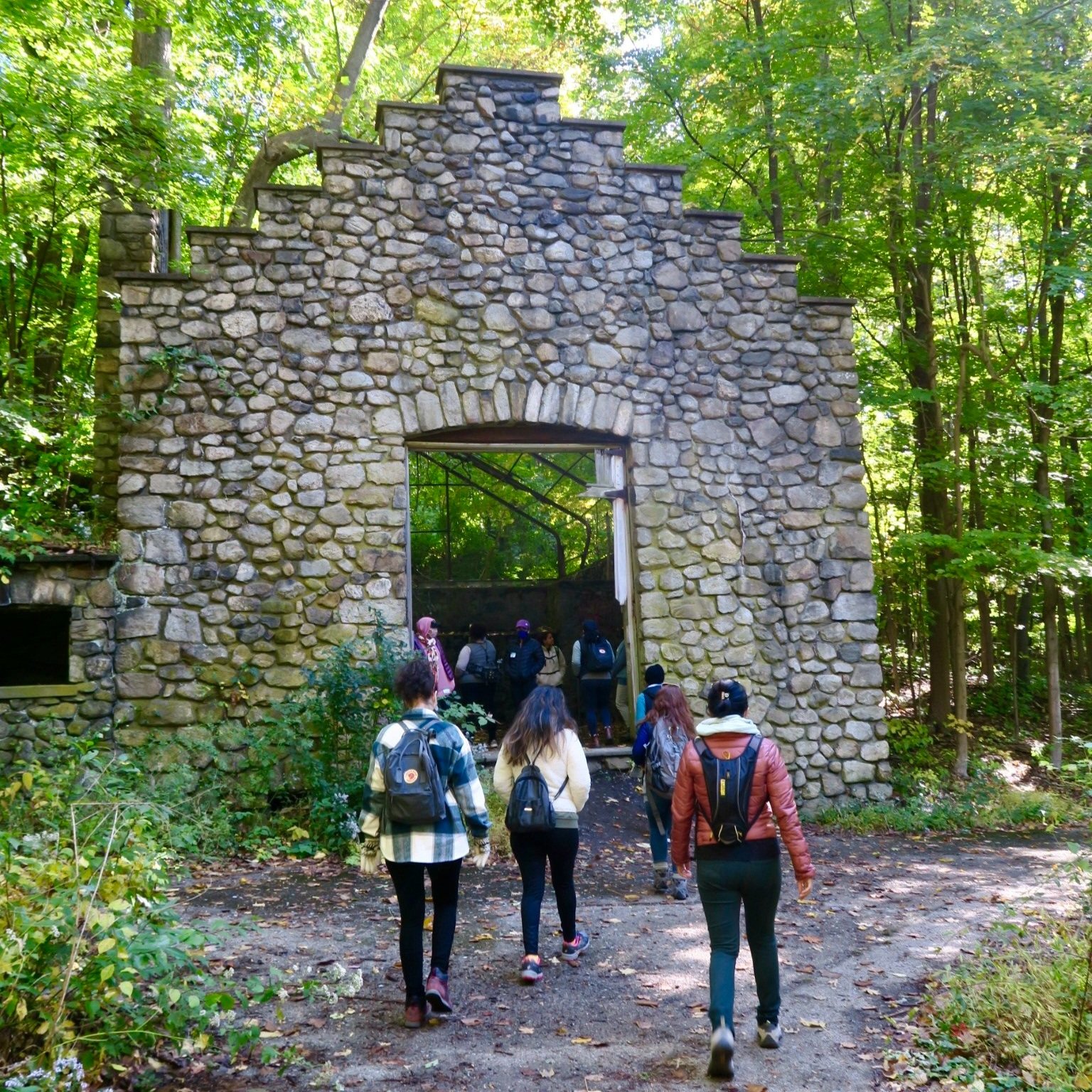
Cornish Estate Trail near Cold Spring, New York off the Metro-North.
All of these hiking trails have this in common: relatively flat, under 3 miles, and are perfect if you’re new to hiking or want to try an easy hike this winter.
A few things to remember:
Getting there: You can get driving directions by copying/pasting the GPS coordinates below into Google Maps or Waze
Hiking boots or sneakers?: If you plan on venturing off to where the trail gets more advanced then I advise wearing hiking boots, porque better to be safe than sorry!
Solo or with friends?: If you’re riding solo, please always let someone know where you are going, what time you plan on returning, and always trust your intuition no matter what. Your third eye don’t lie. If it feels off, it’s because it is.
Hiking rules?: Please follow the Leave No Trace guidelines when enjoying nature and remember that we’re on occupied land so be sure to acknowledge the land you’re on by checking out the Native Land app. Be sure to pack your top 10 essentials for your hike!
Hacklebarney Loop Trail (NJ)
About the trail: (Beginner/Moderate) The Hacklebarney Loop Trail is a 2.1 mile heavily trafficked loop trail located near Long Valley, New Jersey that features a river. The trail is pretty paved but there is a small section where it’s a bit rocky but if you’re wearing sturdy shoes, you will be fine. If you’re traveling with older folk who don’t feel comfortable then you might have to stop there and turn back but you will have seen a good amount of the trail by then. No big deal. It will be more than enough for the older folks.
Distance: 2.1 miles
Parking: The lot is relatively spacious BUT can fill up quickly on the weekends
Bathroom: Located right at the trailhead
GPS Coordinates: 40.751107, -74.732544
Stairway to Heaven Trail (NJ)
Stairway to Heaven Trail in New Jersey.
About the trail: (Beginner/Moderate) This is one of the most beautiful hikes in New Jersey. But what will catch your eye is this magical little walkway that goes through an actual cow pasture. Once the walkway ends, you have the option to climb up Wawayanda Mountain. This is where the “moderate” aspect of the hike comes in because for the most part you’re walking along a boardwalk like-trail which is muy pleasant. Older folks & children love this hike but pack waterproof shoes if it rained the day before, it can get muddy.
Distance: 3 miles
Parking: Limited parking spaces on the side of the road. But there's another lot at the base of Wawayanda Mountain.
GPS Coordinates: N41 14.084 W74 28.852
Cornish Estate Trail (NY)
Cornish Estate Trail near Cold Spring, New York.
About the hike: (Easy/Beginner) This trail is off the Metro-North near Cold Spring, NY which is a popular hike because of “the ruins of a grand old estate."
Distance: 1.8 miles
Parking: Get there early, it fills up quickly on the weekends.
Bathroom: Porterpotties located right at the trailhead.
GPS Coordinates: 41.426810, -73.965680
Let me know if you want me to recommend moderate or advanced hikes by commenting below or emailing me at hola@recla.ma


